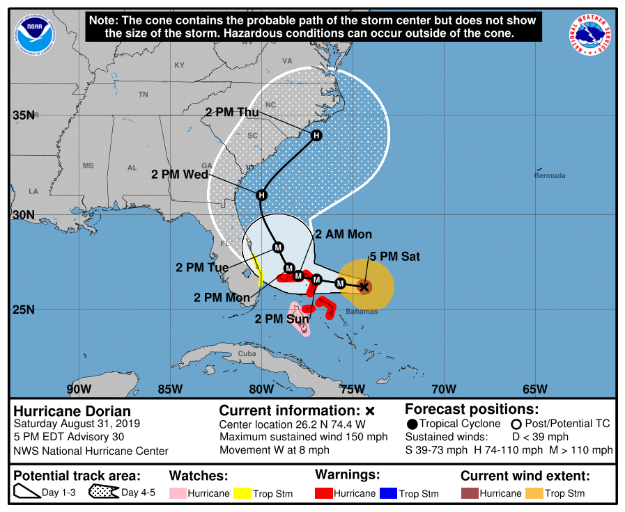
Hurricane Dorian continues to track east of Florida, meaning the eye of the storm is not expected to make landfall on the state. However, parts of Florida are still in the cone of uncertainty, as the storm could possibly end up hitting Florida. Florida is now in a tropical storm watch which is an improvement over recent forecasts. Dorian is now expected to make landfall in the Carolinas.
Here’s the latest update from the National Hurricane Center:
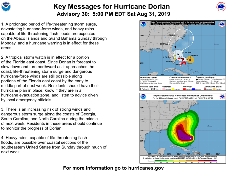
Key Messages:
1. A prolonged period of life-threatening storm surge, devastating
hurricane-force winds, and heavy rains capable of life-threatening
flash floods are expected on the Abaco Islands and Grand Bahama
Sunday through Monday, and a hurricane warning is in effect for
these areas.2. A tropical storm watch is in effect for a portion of the Florida
east coast. Since Dorian is forecast to slow down and turn northward
as it approaches the coast, life-threatening storm surge and
dangerous hurricane-force winds are still possible along portions of
the Florida east coast by the early to middle part of next week.
Residents should have their hurricane plan in place, know if they
are in a hurricane evacuation zone, and listen to advice given by
local emergency officials.3. There is an increasing risk of strong winds and dangerous storm
surge along the coasts of Georgia, South Carolina, and North
Carolina during the middle of next week. Residents in these areas
should continue to monitor the progress of Dorian.4. Heavy rains, capable of life-threatening flash floods, are
possible over coastal sections of the southeastern United States
from Sunday through much of next week.
Stay tuned to WDWNT as we update this story as news develops.