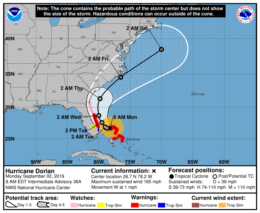
Hurricane Dorian made landfall in the Bahamas yesterday as a Category 5 major hurricane, with sustained winds of 185 mph and gusts over 220 mph, making it a “catastrophic” storm with “devastating winds,” according to the National Hurricane Center.
It’s since stalled in the Atlantic Ocean, hovering over The Bahamas at a mere 1 mph while edging closer towards Florida’s east coast, with no sign of turning in sight. It is currently 145 miles away from West Palm Beach.
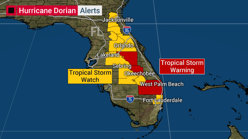
As the current forecast stands, Central Florida will feel impacts on Tuesday and Wednesday, with South Florida potentially seeing impacts as early as this afternoon. (Live update: It’s looking pretty ominous outside.) A Tropical Storm Watch has been issued for the Orlando area as well. Life-threatening storm surge and hurricane-force winds are expected along portions of the Florida east coast through mid-week.
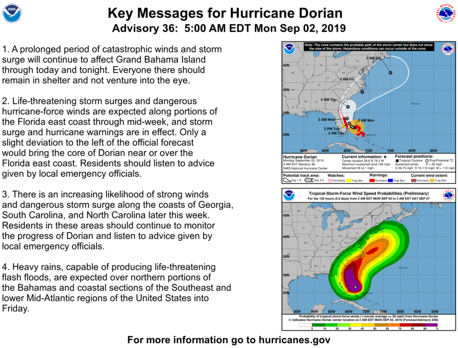
Here are the Key Messages for Hurricane Dorian per today’s 5:00 AM update from the National Weather Service:
As a reminder, tolls have also been suspended to help ease congestion with evacuees leaving the southeast coast of Florida ahead of Hurricane Dorian. The following tolls have been suspended:
Tolls suspension includes:
✔️Alligator Alley
✔️Turnpike Mainline (SR 91), including the Homestead Ext (SR 821)
✔️Sawgrass Expressway (SR 869)
✔️Beachline Expressway (SR 528)
✔️595 express
✔️95 express
✔️75 express
✔️SR 417
✔️SR 429— FLORIDA DOT (@MyFDOT) September 1, 2019
Per the Orlando Sentinel,
In its 8 a.m. update, the National Hurricane Center said Hurricane Dorian maximum sustained winds had dropped to 165 mph with 200 mph gusts. The storm remains over Grand Bahama Island, about 35 miles east of Freeport Grand Bahama and about 120 miles east of West Palm Beach. The cone of uncertainty still includes much of east Central Florida including downtown Orlando.
“Dorian remains an extremely strong hurricane that is forecast to be just east of Central Florida by early tomorrow morning as a Category 3 with winds at 125 mph,” said WOFL-Fox 35 meteorologist Jayme King. “Impacts here in Central Florida will depend on how close the storm gets but, all residents in Central Florida should be prepared and vigilant as any movement to the West would bring bigger impacts to the Central Florida area.”
The Orlando International Airport has stated it would lift its original plans to close on Monday, September 2nd and will be continuing commercial flights until further notice.
You can check for any further updates for Hurricane Dorian from the National Hurricane Center here, and read up on Walt Disney World’s hurricane policy here.
We ask that all of our readers within the cone of uncertainty please have their preparations ready by today, and to keep safe! We will continue to update as futher advisories are issued.